


 Download(2.77MB)
 1.0.8
1.0.8
 5.24MB
8.8
Bike Lanes and Bike Sharing Station in The Territory of Lecce.
BIKEMAP - Lecce was born from the desire to encourage sustainable mobility in the urban area of the city of Lecce through the exploitation of:
1. Bike sharing stations
2. Cycle paths
3. Limited traffic areas and pedestrian areas
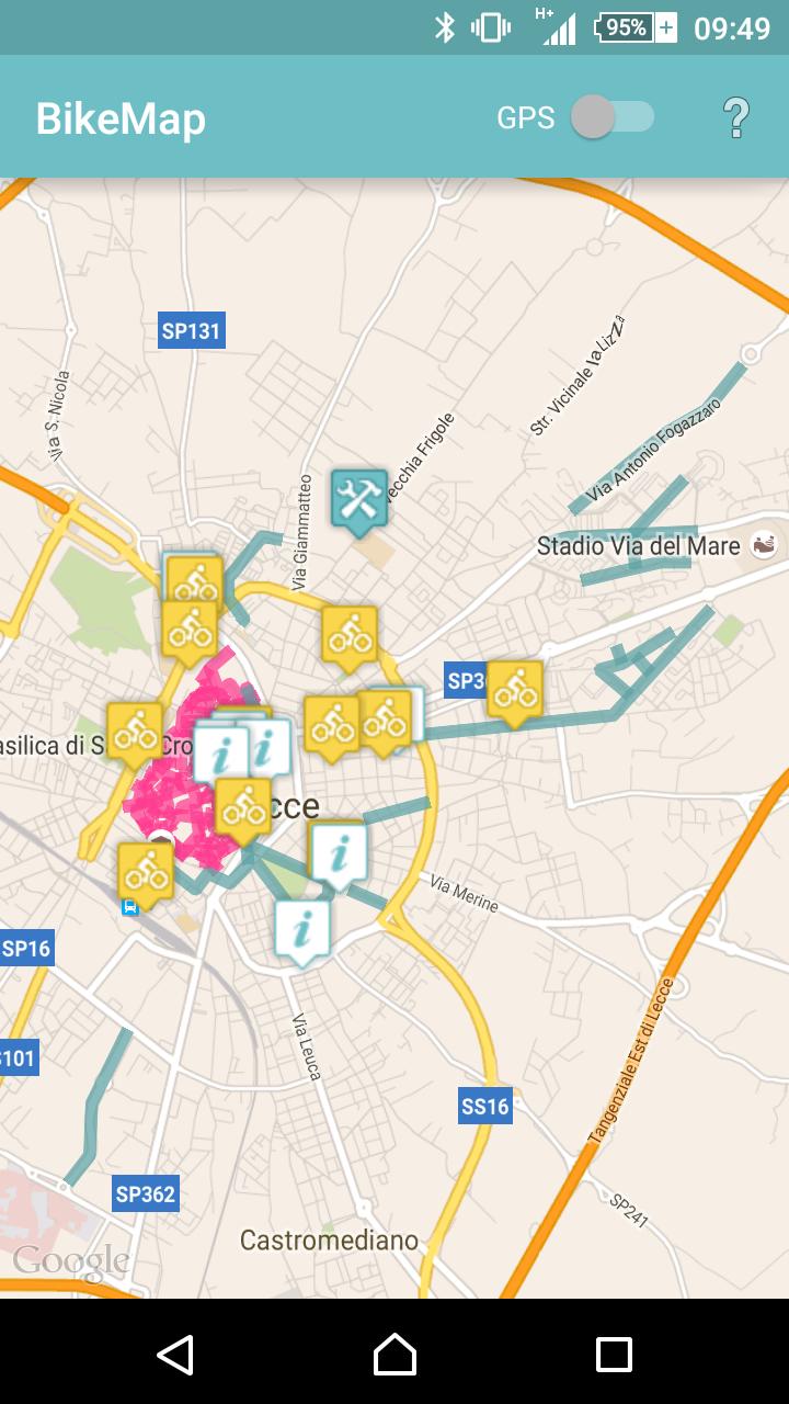
The app consists of an interactive map (limited to the urban area of Lecce and neighboring areas) and a tracking service through GPS location services.
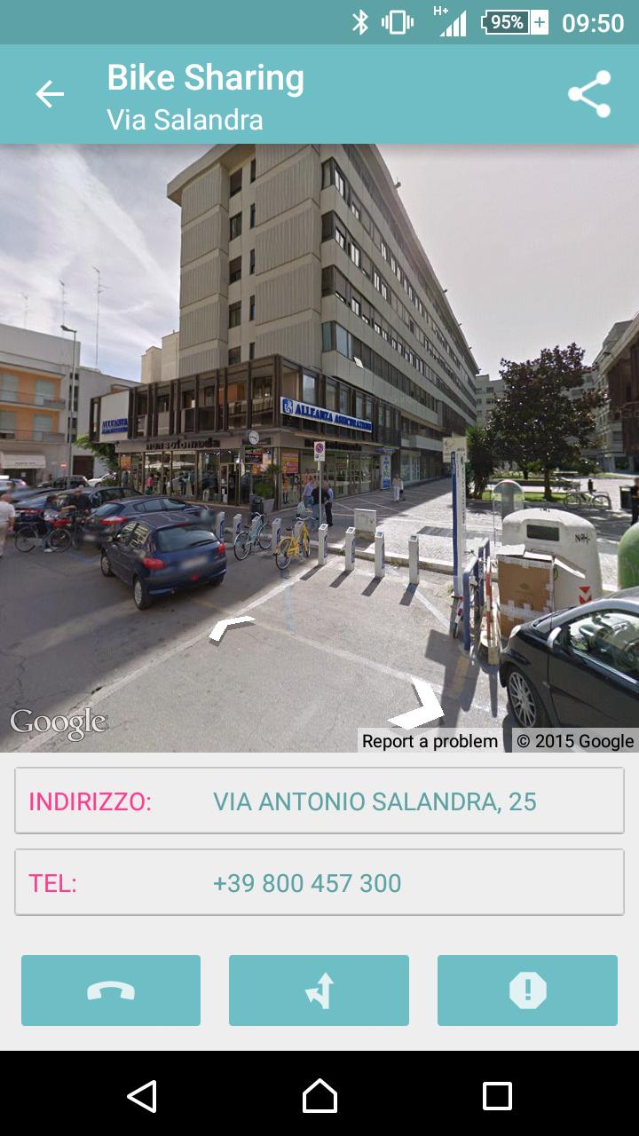
On the map, the bike sharing stations are pinned on the map. For each of them, the user will be able to access the detail view composed of an interactive overview (offered by Google Streetview) and a sharing menu. The cycle paths are highlighted through broken turquoise color lines, while limited traffic areas and pedestrian areas are highlighted through broken orchid color lines.
By activating the GPS tracking, through the appropriate switch in the upper bar bar, the user can view his position in real time on the map, which will be automatically moved and moved by respecting the level of zoom set by the user himself. This feature allows you to know the distance of all bike sharing stations and to use the app as a simple navigator.
 Similarity
January 22, 2026
January 22, 2026
January 21, 2026
January 21, 2026
January 21, 2026
January 21, 2026
January 21, 2026
January 21, 2026
January 21, 2026
January 20, 2026
January 20, 2026
January 20, 2026